Unlock Spatial Insights with DataPalette
Harness the power of spatial data. Our geospatial analysis services span a wide range of applications, turning complex data into concise spatial insights.
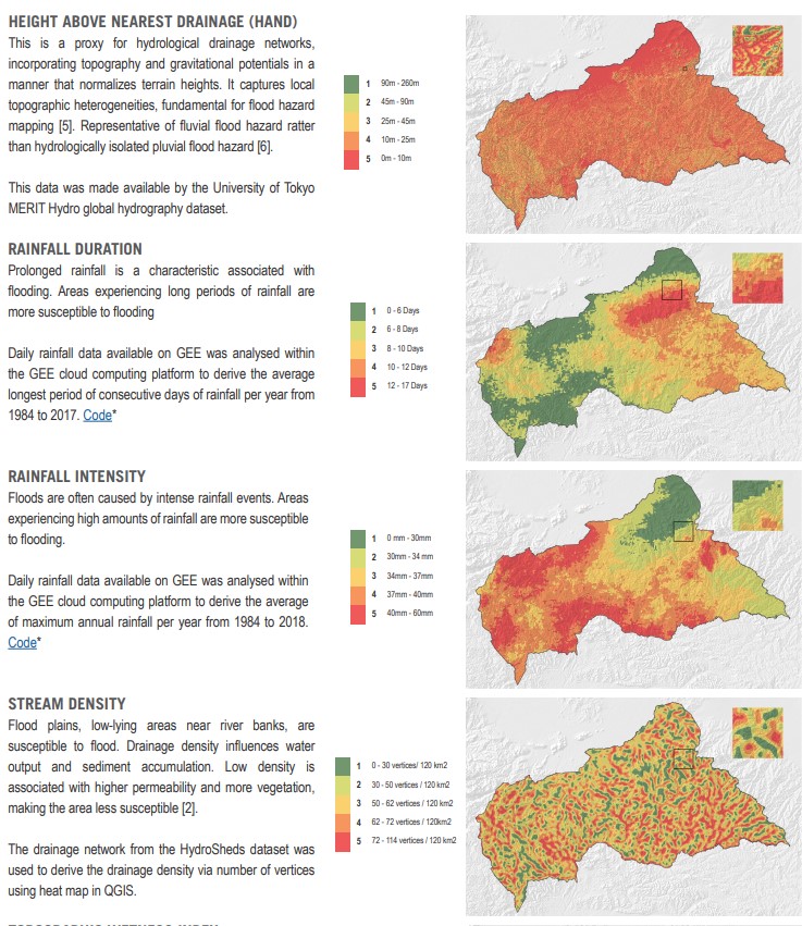
Remote Sensing & Satellite Imagery
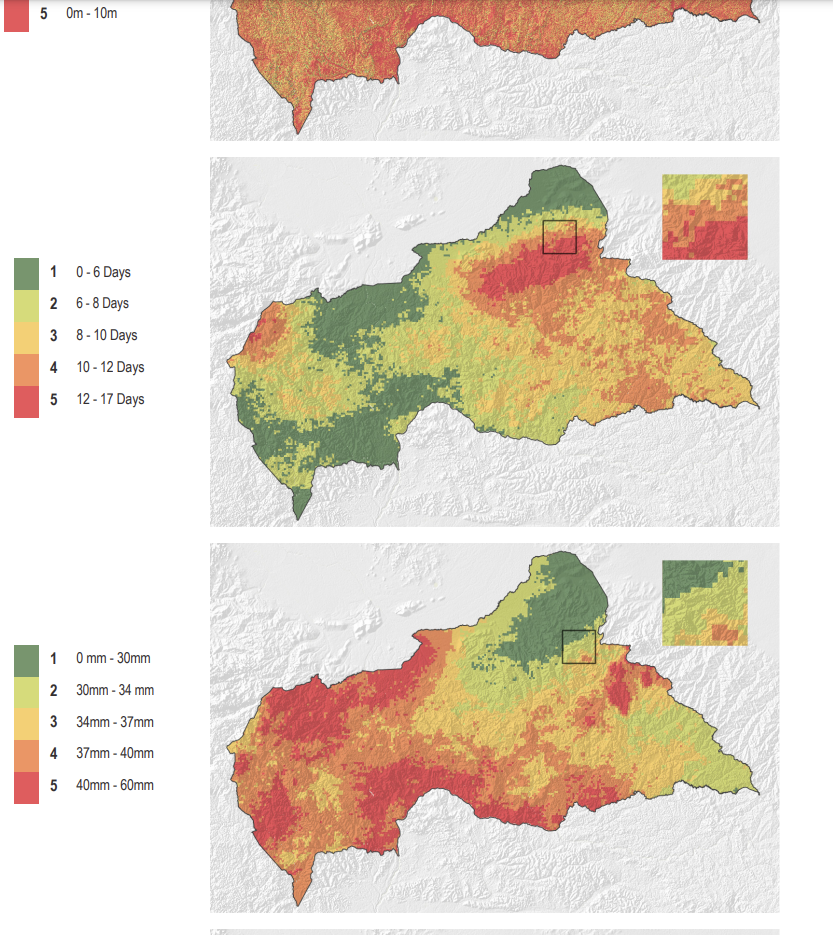
Extract insights from satellite data to monitor environmental changes, track land use, and assess impact.
Key Services: Land cover analysis, change detection, vegetation and water indices (NDVI, NDWI), suitability analysis, and custom image processing.
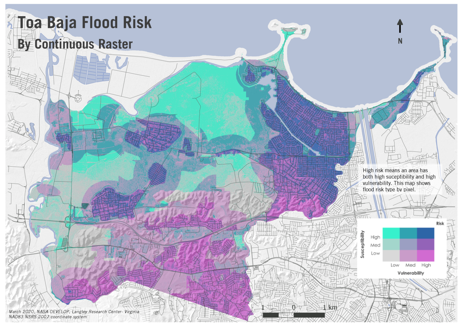
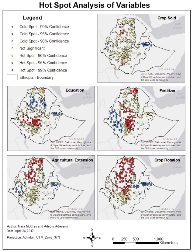
Vector Analysis & Spatial Modeling
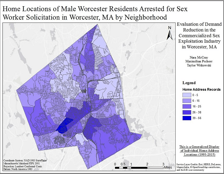
Use spatial data to uncover patterns and optimize planning. From identifying hotspots to mapping the best routes, we can bring you in-depth spatial insights.
Key Services: Hotspot analysis, viewshed analysis for planning, route optimization, and site suitability.
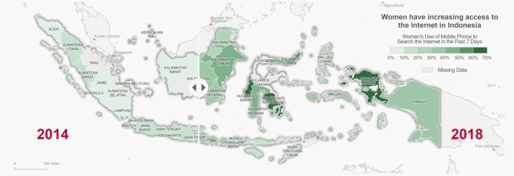
Household Survey Data Analysis
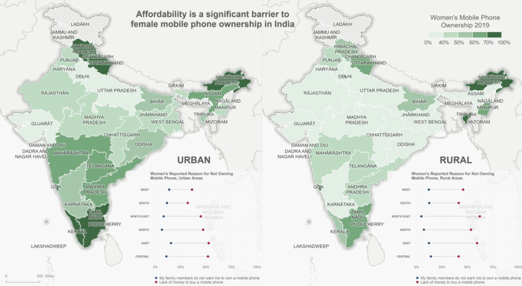
Reveal spatial trends in survey data to better understand your community or target area. See a new dimension of your data.
Key Services: Spatial depictions of survey data, trend mapping, and visualizing key indicators.
